
Section 1.5
Western Science Methodology
Field and analysis methodology from a western science perspective.
Camera Deployment
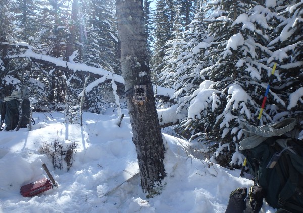
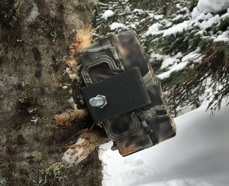
Wildlife cameras were deployed by three McMurray Métis trappers using a random sampling design relative to their trapping trails on traplines, in collaboration with InnoTech Alberta.
Each trapper provided a map of usable trails within their trapline, and random sites were selected along these, alternating from the left to the right side of the trail. Cameras were placed at a random distance between 25 and 250 m perpendicular to the trail, and were a minimum of 1 km apart. Cameras were deployed in a circle up to 50 m from the selected location to find an area with a field of view 5 m wide and 10 m long, to allow for clear images and minimize vegetation triggering the cameras.
For each trapline, in addition to the 18 units deployed at pre-selected random locations, seven units were placed at locations chosen by the trapline holders (e.g., hot spots, area of interest).
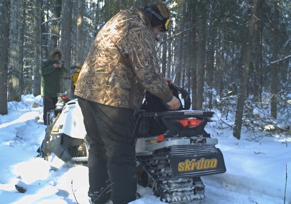
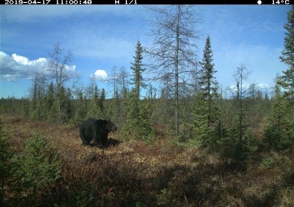
The trappers deployed cameras in winter 2018 and spring 2019, and obtained the first round of images as part of a camera refresh process in spring 2020. McMurray Métis members were then trained to upload images to the data processing software WildTrax. In collaboration with the ABMI, images were processed and a first round of data analysis was undertaken. A second round of images was obtained in early 2021; the associated analysis will be included in a future report update.
Data Analysis
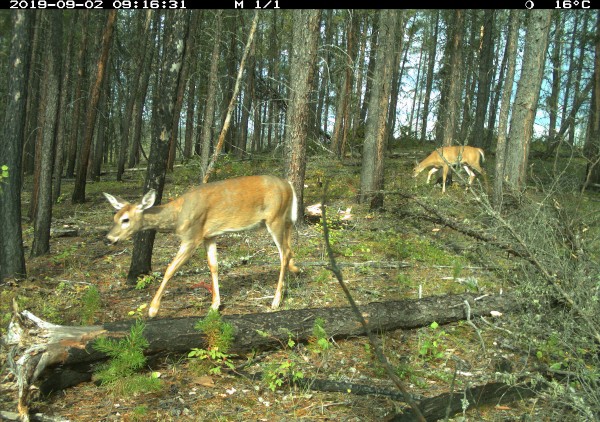
Images collected from the cameras were used to estimate the density of various mammal species on each trapline based on standard ABMI methods. This is done by calculating the time each species is recorded in the camera field of view, the detection distance of the camera in each habitat type, and the duration of time the camera was operating (Huggard 2019). The density calculation for each camera deployment was also used to infer impacts of human development (primarily industrial) on hunted and trapped species of interest to McMurray Métis trappers: black bear, moose, white-tailed deer, and gray wolf.
Secondly, changes in human footprint (see Chapter 2 for definitions of human footprint categories) over time were determined at the scale of Métis Harvesting Area B (see Chapter 2 for a description of the region) using two methods: ABMI’s full coverage Human Footprint Inventory for 2010 and 2018, and ABMI’s sample-based 3x7 km inventory across the Lower Athabasca Region between 1950 and 2018 (specifically 1950, 1980, 2000, 2001, and 2004–2019).
The 3 x 7-km sample-based human footprint information is used to track short- and long-term changes and trends in human footprint in Alberta.
Land cover classifications used in describing the three spatial scales in this project (Métis Harvesting Area B, trapline, and 50 m around individual camera sites) were done using data from the Alberta Wall-to-Wall Vegetation Layer (ABMI 2017). This is the most complete provincial landcover layer and includes source data from the following:
- Extended Alberta Vegetation Inventory (AVIE)
- Grassland Vegetation Inventory (GVI)
- Primary Land and Vegetation Inventory (PLVI)
- Central Parkland Vegetation Inventory (CPVI)
- Ecological Land Classifications layers for mountain national parks (MTNP)
- Vegetation layers for Wood Buffalo National Park (WBNP)
- Elk Island National Park (EINP)
- Phase 1 (Broad Scale) Forest Inventory (Phase 1)
- the Alberta Wall-to-Wall Land Cover polygon vector layer created by the ABMI Remote Sensing Group (ABMI Land Cover).
Human Footprints were 'backfilled' with vegetation using various techniques to create a seamless vegetation layer. In addition, the Alberta Merged Wetland Inventory was used as supplementary data added to each polygon to aid analyses.
Finally, changes in fire-affected areas were determined using fires that occurred between 1935 and 2020 for three spatial scales: Métis Harvesting Area B, trapline, and 50 m around individual camera sites.
Fire data were obtained from the Government of Alberta Wildfire Centre.
References
Alberta Biodiversity Monitoring Institute. 2017. Alberta Wall-to-Wall Vegetation Layer Including “Backfilled” Vegetation in Human Footprints (Version 6). Document Version: June 2, 2017. Available: https://www.abmi.ca/home/publications/451-500/467
Huggard, D. 2018. Animal Density from Camera Data. Alberta Biodiversity Monitoring Institute, Edmonton, Alberta. Available: https://www.abmi.ca/home/publications/501-550/516.